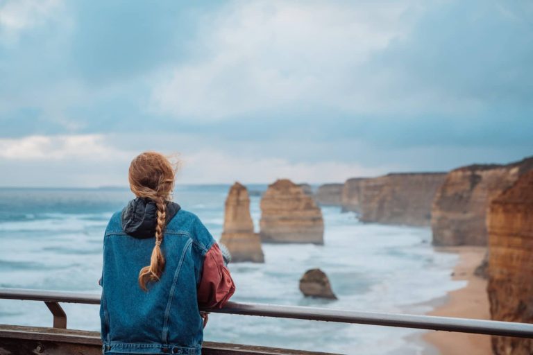
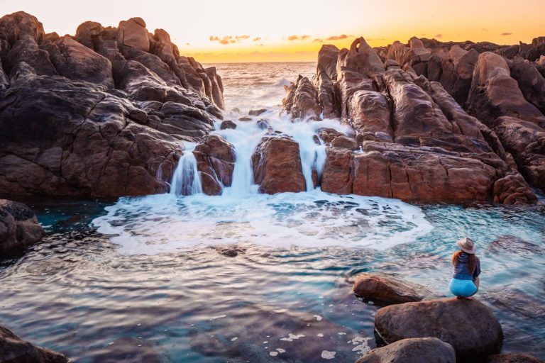
21 Blue Mountains Walking Tracks For ALL Skill Levels

The Blue Mountains are home to some of the most stunning hikes in New South Wales.
You’ll walk through the lush rainforest, see the most amazing waterfalls, and blow your mind with the incredible views of every lookout.
Honestly, it’s hard to believe this gem of a region is at Sydney’s doorstep! And there’s a hike for every kind of traveller.

There are easy hikes like the Three Sisters, perfect for the whole family, while other treks are a bit more challenging but extremely rewarding like the iconic Grand Canyon Walk.
And for those looking for a multi-day adventure, there are plenty to choose from (not only the legendary Mount Solitary hike!).
Whatever hike you choose, try doing it during the cooler months (April–October). The weather is perfect for hiking and there’s less risk of areas closed due to maintenance or flooding.
This guide has our favourite Blue Mountains walking tracks, with options ranging from easy walks to serious treks, so there’s something for everyone!
We’ll share everything you need to know to plan your trip, including tips to help you navigate the mountains like a pro.
Let’s get started!
But first… travel essentials for hiking in Blue Mountains
🛏️Accomodation: Book your next stay here
✈️ Flights: Great deals on flight tickets here
🚗 Car Rentals: Rent a car in Sydney to move around easily! Compare these two rental companies to find the best deal for you: Rental Cars and Discover Cars
🏕️ Caravan Rentals: Rent a caravan in Sydney and camp! You can’t go wrong renting from Travellers Autobarn (budget), Jucy Campervans (medium), or Star RV (luxury).
❤️🩹Insurance: Protect yourself and your loved ones with the best travel insurance in Australia
📞 eSIM: Not from Oz? Grab our favourite eSIM and stay connected at all times!
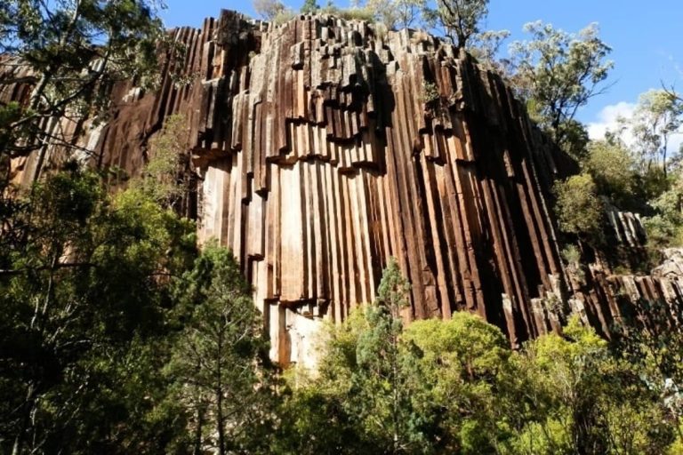
Our favourite hikes in Blue Mountains
We recognise the traditional owners of this land, the Dharug and Gundungurra peoples
1) Grand Canyon Walk
Distance: 6 km, loop hike (2-3 hours)
Difficulty: Moderate
Start/End: Evans Lookout, Blackheath
Highlights: Sandstone walls, lush rainforest, waterfalls, and creek crossings
This is one of the most popular walks in the Blue Mountains, no wonder why! It gives you a taste of everything the region has to offer.

Starting from Evans Lookout, the trail takes you deep into the Grose Valley, winding through the towering sandstone cliffs. You’ll see the lush rainforest and a few waterfalls along the way, too.
The path is well-kept but there are plenty of ascending and descending steps, so bring comfortable shoes and take your time.
Also, try to get there early to beat the crowds – it’s a VERY popular hike and it can get busy.
2) Overcliff-Undercliff hike
Distance: 4.3 km, loop hike (1.5–2 hours)
Difficulty: Moderate
Start/End: Wentworth Falls Picnic Area
Highlights: Stunning cliff views, lush rainforest, Jamison Valley lookouts, and waterfalls
This trail takes you along gorgeous cliff sections with plenty of variety – swamplands, rainforests, and jaw-dropping views of Jamison Valley.


It’s a relatively short loop, but don’t let that fool you – there are lots of stairs and uneven sections that can get muddy after rain, so it can be a bit challenging at times.
There are a few incredible lookouts to take in the views! You might want to account for that when planning your itinerary – have a bit of wiggle room afterwards.
3) Wentworth Falls walk
Distance: 2.7 km, loop hike (1–1.5 hours)
Difficulty: Moderate
Start/End: Wentworth Falls Picnic Area
Highlights: Five lookouts, including Fletcher’s and Rocket Point, plus spectacular waterfall views
This short loop packs a punch with five incredible lookouts – Jamison Lookout, Wentworth Falls Lookout, Fletcher’s Lookout, Rocket Point Lookout, and Princes Rock Lookout.

It’s a bit challenging as, you guessed it, there are several steep stairs. There’s also a variety of terrains, from forest paths to rocky ledges.
If you’re lucky to do this a few days after rain, you’ll catch the falls at their most powerful. The trail can get busy, so plan for a weekday morning to enjoy the serene birdlife and views without the crowds.
4) Burramoko Ridge (Hanging Rock)
Distance: 11.3 km, return hike (2.5–3 hours)
Difficulty: Moderate
Start/End: Blackheath
Highlights: Views from Baltzer Lookout, Hanging Rock, and bush surroundings
This trail follows an easy fire trail for most of the way, making it a nice option for hikers who want to avoid all the stairs and climbing.

The path itself can feel a bit repetitive, but the Baltzer Lookout makes it all worth it – the views of the Grose Valley and the famous Hanging Rock are iconic.
If you’re feeling adventurous, you can do what we did and head to Hanging Rock and jump over the one-metre chasm for the most insane views of your LIFE. It feels like Pride Rock from Lion King:
5) Lockleys Pylon
Distance: 7.1 km, return hike (1.5–2 hours)
Difficulty: Easy-Moderate
Start/End: Near Mount Hay Road, Blue Mountains National Park
Highlights: Panoramic views of Grose Valley, wildflowers, and open bushland
This trail is relatively short but has some of the most spectacular views of the Blue Mountains! And in the wildflower season (spring), you can see all the colourful flowers around.

It also has epic views of Fortress Falls, which is how we found it to begin with – you’ll see this massive waterfall dropping down from the lookout!
The path is well-marked, making it a great option for beginners. Bring sturdy footwear though, there’s a mix of loose rocks, steps, and sandy patches.
Accessing the trailhead involves driving along a very gravelly road, be careful if you’re not on a 4WD.
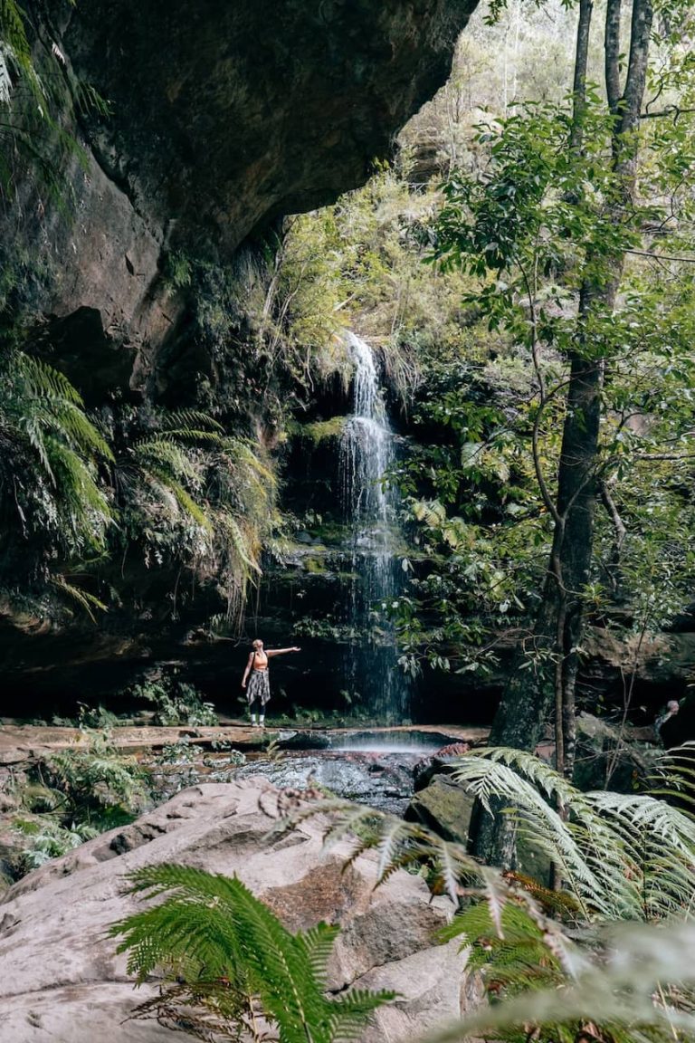
6) Fortress Falls
Distance: 8.4 km, return hike (2.5–3 hours)
Difficulty: Hard
Start/End: Near Fortress Ridge Trailhead
Highlights: Views of Grose Valley, rock scrambling, and scenic pools at the falls
This is a very challenging hike, but it was one of our favourite parts of our visit!

The trail takes you along a ridge with great views of the Grose Valley before descending steeply to Fortress Falls.
The ridge section itself is relatively easy, but the final stretch to the falls involves steep and slippery terrain, as well as some rock scrambling.
At the end is Fortress Falls, which are absolutely stunning! It’s a sheer drop just off a rock ledge with beautiful, crystal clear water coming through, making little, perfect circular pools.
But for your way back, be prepared for a steep climb back up to the ridge. The trail can be vague in parts, so keep an eye out for markers to avoid backtracking.
We recommend downloading the trail map and having it accessible offline before heading there!
7) Glow worm tunnel walking track
Distance: 11.6 km, return hike (4–4.5 hours)
Difficulty: Easy-Moderate
Start/End: Glow Worm Tunnel Road, Wollemi National Park
Highlights: Glowworms, historic railway tunnel, forest scenery
This unique trail combines history and nature! You’ll follow an old railway line through bushland, passing creeks and rocky outcrops.
The tunnel itself is the main highlight, with thousands of glowworms lighting up its pitch-black interior.
The path is well-maintained but steep near the tunnel, with a short scramble to reach the entrance. Keep in mind that the terrain inside the tunnel is damp and uneven, so bring sturdy shoes.
The tunnel is also completely dark, so bring a torch with a red filter to protect the glowworms.
Avoid weekends to skip the crowds. The last section of the road to the carpark is unsealed, so drive carefully if you’re in a 2WD!
8) Echo Point to Scenic World via Giant Stairway
Distance: 4.7 km, point-to-point hike (2–3 hours)
Difficulty: Moderate
Start/End: Echo Point Lookout to Scenic World, Katoomba
Highlights: Giant Stairway, Three Sisters, Federal Pass, Katoomba Falls
This epic hike takes you down 998 steep steps on the Giant Stairway, right beside the Three Sisters. From there, you’ll walk along Federal Pass, a flat track surrounded by lush forest and towering cliffs.

The last leg involves a climb back up to Scenic World. If you’re not up for the stairs, the Scenic Railway offers a steep (but thrilling) ride back up!
Wear sturdy shoes for the stairs and check the Scenic Railway timetable in advance if you want to take it. The last train is at 3:50 pm and it can get busy.
9) Prince Henry Cliff Walk
Distance: 8 km, point-to-point hike (2.5–3 hours)
Difficulty: Moderate
Start/End: Scenic World to Gordon Falls Picnic Area
Highlights: 20 lookouts, Jamison Valley, Three Sisters, Leura Cascades
This track connects some of the most iconic viewpoints in the Blue Mountains.

Starting from Scenic World, you’ll pass the Three Sisters at Echo Point, then continue along the cliff edge towards Leura.
There are over 20 lookouts along the way, offering breathtaking views of the Jamison Valley!
The path is mostly easy with some stairs. It can get crowded near Echo Point, but the further you go, the quieter it gets!
Start early and pack snacks to enjoy at Gordon Falls Picnic Area. Make sure to follow detour signs carefully, some sections can be confusing.
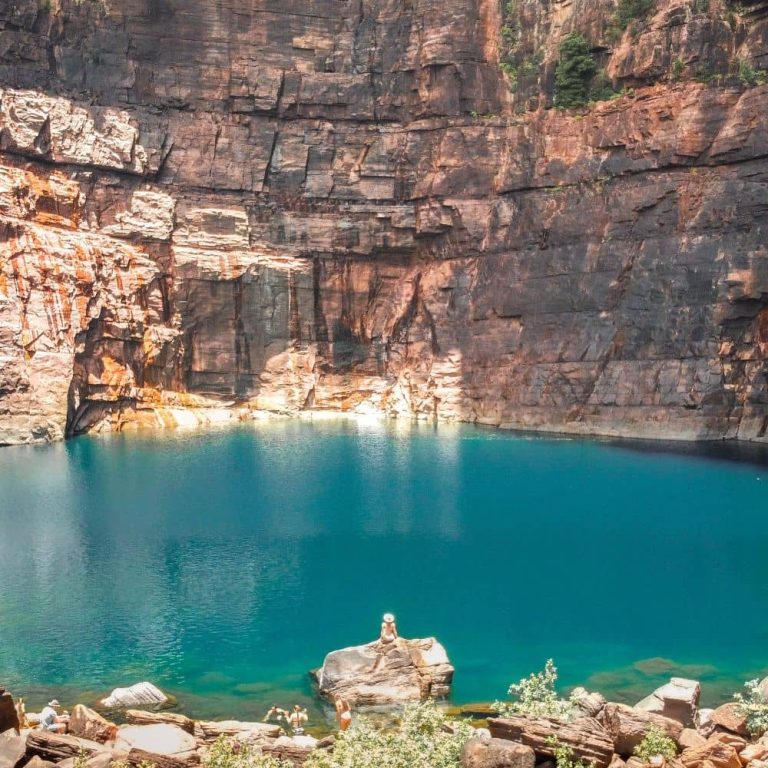
10) Secret Infinity Pool Trail
Distance: 2 km, return hike (40–60 minutes total)
Difficulty: Moderate
Start/End: Leura Cascades Picnic Area
Highlights: Hidden infinity pool, cliff views, and cascading waterfalls
This is a short but thrilling hike that takes you to a natural infinity pool with dramatic views of the Blue Mountains!

It starts at Leura Cascades. The trail follows the Amphitheatre Track through lush rainforest and steep metal staircases to Bridal Veil Falls.
From there, there’s a well-defined off-track path that leads to the pool, with a rope-assisted scramble near the end.
Warning though – the cliff edge does not have a fence and the drop is massive. So stay away from the edge at all times.
The place is not on Google Maps, so we wrote a full guide about this secret infinity pool to help you get there in more detail and know what to expect!
Easy / Short walks to enjoy the Blue Mountains
If you’re looking for a few short hikes to take in the sights or to do with the family, you are going to love these:
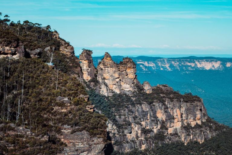
11) Three Sisters Walk
Distance: 1 km, return hike (30 minutes)
Difficulty: Easy
Start/End: Echo Point Lookout, Blue Mountains National Park
Highlights: Views of the Three Sisters, Jamison Valley, and Lady Game Lookout
This short, accessible walk is one of the most famous in the Blue Mountains.
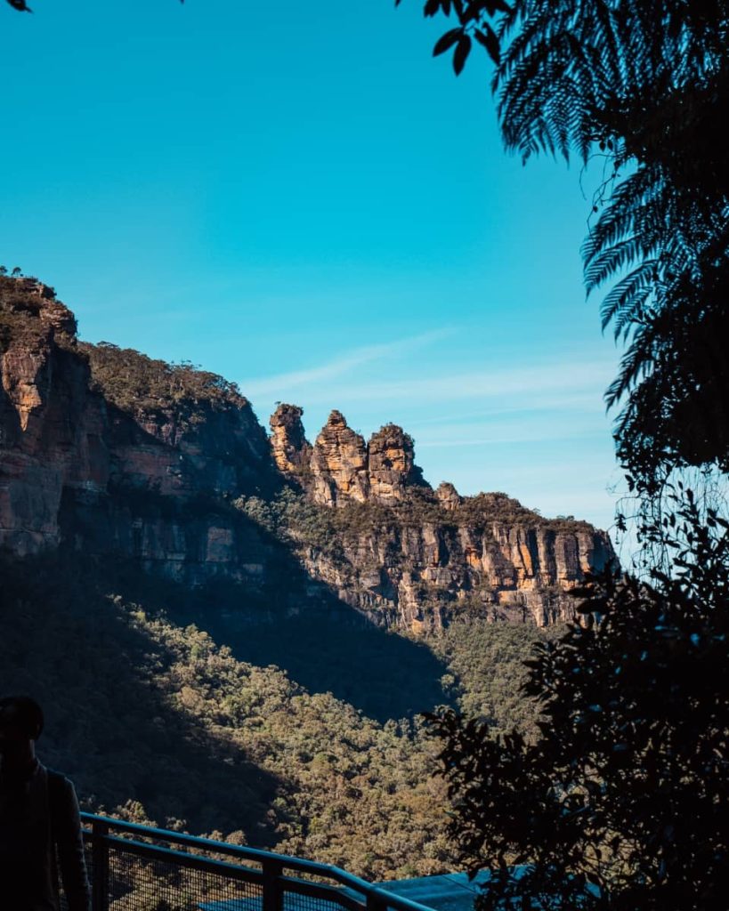
Starting from Echo Point, the paved trail leads to Lady Game Lookout for stunning views of the Three Sisters.
For those wanting a closer look, the track descends to Honeymoon Bridge, which connects to the first Sister.
Although the trail is easy, it gets VERY crowded, especially during weekends and holidays. Arrive early to secure parking and enjoy the views without the rush.
Parking fees can be steep, so factor that into your visit.
12) Darwins walk
Distance: 2.4 km, one-way hike (45 minutes–1 hour)
Difficulty: Easy
Start/End: Wilson Park to the Blue Mountains National Park boundary
Highlights: Jamison Creek, rock pools, birdwatching, and waterfalls
This trail retraces the steps of Charles Darwin, who walked here in 1836.

Starting at Wilson Park in Wentworth Falls, the track follows Jamison Creek through hanging swamps, open forests, and cascades. There are small pools along the way, perfect for cooling off mid-hike!
The walk ends at the boundary of Blue Mountains National Park, where you can continue to Weeping Rock or Fletcher’s Lookout for more spectacular views of Wentworth Falls and Jamison Valley.
The path is well-marked but can be muddy after rain.
If you don’t want to retrace your steps on the way back, take Falls Road (from Wentworth Falls) back to town for a different route.
13) Empress Falls
Distance: 1.4 km, return hike (30–40 minutes)
Difficulty: Moderate
Start/End: Valley of the Waters Track, Wentworth Falls
Highlights: Empress Falls, Sylvia Falls, rainforest, and canyon views
This short but steep trail offers a quick adventure into the Valley of the Waters.

You’ll climb down some stairs in the lush rainforest to reach the cascading Empress Falls, a popular spot for canyoners. The track continues to Sylvia Falls, offering more stunning views.
The stairs can be challenging on the return (over 800 steps!), especially after rain when they’re slippery. The trail gets busy too, so try to visit early!
14) Bridal Veil Lookout via Leura Cascade
Distance: 1.8 km, loop hike (30–40 minutes)
Difficulty: Moderate
Start/End: Leura Cascades Picnic Area
Highlights: Bridal Veil Lookout, rainforest, and cascading waterfalls
This short, family-friendly trail showcases the beauty of Leura Cascades and Bridal Veil Lookout!

The path includes gentle slopes and stairs, leading to jaw-dropping views of Leura Cascades and the Jamison Valley.
It’s great if you want to bring the whole family for a day in nature!
15) Rocket Point lookout
Distance: 4.3 km, return hike (1–1.5 hours)
Difficulty: Moderate-Hard
Start/End: Wentworth Falls Picnic Area
Highlights: Rocket Point Lookout, Queen’s Cascades, and valley views
This relatively short trail leads to Rocket Point Lookout, which offers sweeping views of the valley and Wentworth Falls.

Along the way, you’ll pass Queen’s Cascades and cross-stepping stones surrounded by ferns and moss, it’s beautiful.
The walk to the lookout is steep but manageable as the steps are well-kept. But the trail can get very muddy after rain, so wear waterproof shoes.
Multi-day Blue Mountains hikes for the pros
For those looking for something more challenging, here are some of the best multi-day hikes in the Blue Mountains:
16) Grand Cliff Top Walk
Distance: 18 km, point-to-point hike (5–6 hours, 2 days)
Difficulty: Hard
Start/End: Wentworth Falls to Scenic World
Highlights: Panoramic views of Jamison Valley, Three Sisters, Wentworth Falls, and historic sandstone tracks
This hike takes you through the main highlights of the Blue Mountains!

Spanning 18 km, it connects Wentworth Falls to Katoomba’s Scenic World, passing through a mix of stunning lookouts, lush forests, and cliff-edge paths.
While the trail is well-marked, you’ll encounter steep stairs, occasional detours, and some sections along roads in Leura.
Some hikers could do this in 1 day, but it’s recommended to do it in 2 days. This allows time to enjoy the scenery, including waterfalls and birdlife like lyrebirds and black cockatoos.
If you want to do it in a single day, consider starting at Scenic World – you’ll have more downhill sections, so it will be easier on your knees.
17) Lockleys Pylon to Victoria Falls via Blue Gum forest
Distance: 19 km, point-to-point hike (6–7 hours, 2-3 days)
Difficulty: Hard
Start/End: Lockleys Pylon to Victoria Falls Road
Highlights: Blue Gum Forest, Grose Valley views, and Victoria Falls
This challenging point-to-point hike connects Lockleys Pylon with Victoria Falls via the Blue Gum Forest.

The trail starts in Lockleys Pylon. Now, the walk down to Blue Gum Forest is awesome but doesn’t have much signage. There are also some rocky sections, it took us a lot of focus to get down.
Most people break the hike there and stay at Acacia Flat campground overnight, which is what we did. The campsite is excellent!
From the campsite you can either do the Perrys Lookdown hike or continue to Victoria Falls – we did the latter.
The climb out of the valley towards Victoria Falls is a bit steep, so good fitness and sturdy footwear are essential.
Now, doing this as an overnight hike was very rough for us, we were exhausted by the end!
We recommend spending the night somewhere in Victoria Falls before continuing up out of the cliff to go to your car.
Signage isn’t good either, so follow the map exactly according to All Trails (here).
18) Mount Solitary hike
Distance: 33 km, loop hike (3 days)
Difficulty: Very Hard
Start/End: Furber Steps, Katoomba
Highlights: Ruined Castle, Mount Solitary summit, and Kedumba Valley
This multi-day hike is one of the most challenging -and rewarding- routes in the Blue Mountains. It’s for experienced hikers only.

Starting from Furber Steps, you’ll walk through dense rainforest, see amazing waterfalls, and check out iconic rock formations like the Ruined Castle.
Then, you’ll climb Mount Solitary – take your time because the climb is steep and rocky!
On the second day, you’ll go from Mt Solitary to Kedumba Valley. There are some bushcamping options there. And on the last day, you’ll make your way back to Katoomba via a fire trail.
Carrying enough water is critical, as refill points are sparse and require purification.
Check for closures and carry a map or GPS because the trail is poorly marked in places. Plan for cooler months to avoid heat exhaustion.
19) Blue Gum forest hike
Distance: 23.3 km, loop hike (7–9 hours or overnight)
Difficulty: Hard
Start/End: Perrys Lookdown or Pierces Pass
Highlights: Blue Gum Forest, Grose Valley, and Acacia Flat Campground
This classic hike takes you to the heart of the Blue Mountains.

Starting from Perrys Lookdown, the trail descends steeply into the Grose Valley, where you’ll find the majestic Blue Gum Forest.
The climb back out is a test of endurance, but the beauty of the valley makes it worth the effort. Most people camp at Acacia Flat campground!
Begin early to allow extra time for steep sections and bring a downloaded map to navigate detours caused by track closures (if any).
20) Pierces Pass
Distance: 16.3 km, return hike (5-6 hours one way, overnight)
Difficulty: Hard
Start/End: Pierces Pass Road to Blue Gum Forest
Highlights: Grose River, Blue Gum Forest, towering cliffs, and dramatic valley scenery
This hike is a rewarding adventure through the heart of the Blue Mountains!

Starting at Pierces Pass, the trail descends steeply into the Grose Valley, with stunning views of the rock walls along the way.
The track levels out as you approach the Grose River, where you can cool off or refill water with proper filtration.
The trail can become overgrown in parts, especially near the river. Start early, wear long pants to protect against prickly plants, and bring trekking poles for stability during the descent and ascent.
The climb back out is steep and strenuous, so tackling this hike as an overnight trip is recommended for most walkers. Once again, Acacia Flat Campground is the best place to camp there!
21) Narrow Neck Trail
Distance: 25.3 km, return hike (7–8 hours or 2 days)
Difficulty: Moderate to Hard
Start/End: Narrow Neck Plateau
Highlights: Megalong Valley, Jamison Valley, Wild Dog Mountains, and Lake Burragorang
This iconic Blue Mountains trail follows the Narrow Neck Peninsula, a ridge dividing the Jamison and Megalong Valleys.

The path is a wide fire trail, popular with hikers and mountain bikers, with sweeping views along the way.
Most hikers tackle this as an overnight trek, setting up camp at one of the designated sites along the ridge.
The trail is undulating, with a few steep climbs, but the views at the end are well worth the effort. At the final lookout, you’ll enjoy the views of Wild Dog Mountains and a glimpse of Lake Burragorang.
There’s little shade on this trail, so pack a hat, sunscreen, and plenty of water. The fire trail can feel repetitive, but side paths often lead to hidden viewpoints!
Top Tips
Don’t rely 100% on the signage to guide you, it can be very vague in certain sections. The most popular tracks have decent markers, but many trails have minimal or confusing signage.
We recommend downloading the AllTrails app or a similar map tool. You can download the map so you know exactly where you’re going, especially on lesser-known paths or when detours pop up unexpectedly.
Also, always plan to finish your hike well before sunset. The sun sets behind the mountains, meaning it gets darker faster than you might expect in some areas.
And check for local alerts before you set out. Maintenance, landslides, and closures can affect access to certain sections of trails, and you’ll want to know ahead of time to avoid frustration.
The NSW National Parks website is a reliable resource for up-to-date information on closures and conditions, check it here!

Did you know?
Many Blue Mountains trails, like the Glow Worm Tunnel Track, follow the paths of old railway lines! This is because, in the early 20th century, this region played a key role in the shale oil industry.
After they fell into disuse, the abandoned tunnels were later claimed by glowworms, creating today’s enchanting, otherworldly light show for hikers.
FAQs
What is the easiest walk in the Blue Mountains?
The Three Sisters Walk is the easiest walk in the Blue Mountains, with a 1 km return track that’s paved and well-maintained.
Our Essential Travel Toolkit
🤩 Wise Card – Online bank to hold money in different currencies worldwide and lowest fees in the market! (FREE debit card here)
🤩 Trip.com – Consistently great accommodation and hotel deals.
🤩 Hostelworld – Looking for the cheapest accommodation? We especially love the “book now, pay later” feature.
🤩 Discovercars.com – Best range, super easy to compare prices rental car and motorhome prices.
🤩 Viator.com – Easily book tours and experiences at the lowest rate. Great selection all over Australia.
🤩 Tripadvisor.com – Other than our website…😉 the best place to find things to do
🤩 Airalo – eSIM store that solves the pain of high roaming bills by giving travelers access to eSIMs (digital SIM cards).
🤩 Caravan RV Camping – Traveling Australia in a van, caravan or bus? This is the best place to get all your gear.